NWS forecast: Patchy fog after 5am. Mostly cloudy, with a low around 62. West southwest wind 0 to 5 mph. Davis VP+ forecast:Increasing clouds with little temperature change.
Monday
Patchy Fog then Mostly Sunny
Hi 81 °F
NWS forecast: Patchy fog before 11am. Mostly sunny, with a high near 81. West southwest wind 0 to 10 mph.
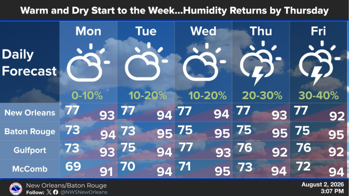
Lower humidity and rain chances will be in place to start the workweek. Rain chances will be less than 20 percent each day through Wednesday and the lower humidity will keep heat index values around 100 degrees. The humidity returns on Thursday and Friday allowing for more scattered afternoon thunderstorm activity and higher heat index values of around 105 degrees. Highs will climb into the low to mid 90s and lows will fall into the mid 70s each day this week.


