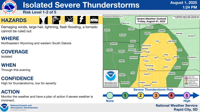
Dry and warmer weather is expected today, with sunny skies and highs in the 70s across most locations. A cold front moving through late this afternoon and early this evening will bring gusty northwest winds. Slightly cooler temperatures are expected Sunday, with some showers and isolated thunderstorms across northeast Wyoming and far western South Dakota. Unsettled weather will continue through the first half of the week. Some parts of northeastern Wyoming and the Black Hills may see snow with minor accumulations Monday night through Wednesday.
Data Courtesy of Rapid City Weather Forecast Office